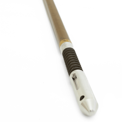
NORTHFINDER

True MEMS gyro compass
The NorthFinder is based on MEMS gyro sensors which gives a rugged survey system in a 32 mm housing. The NorthFinder takes independent readings at survey stations, giving the gyro toolface and azimuth and also provides inclination as well as gravity highside. The main purpose of the NorthFinder is to serve as an independent reference together with the isGyro for deep vertical boreholes.

Low power technology
The NorthFinder has a very low power consumption due to being based on MEMS sensors, consuming as little as 1 W of power. This is especially useful when running the instrument in a heat shield as it vastly improves the downhole time, generating very little heat compared to competing systems.

Fast WiFi transfer
The gyro compass and accelerometer data are transferred to the field computer using WiFi which ensures very fast data transfer. The transfer time is less than a minute even for large surveys. The NorthFinder survey software is easy to use and install. The survey software runs on multiple Windows platforms including XP, 7, 8, 10 on both 32 and 64-bit systems.

Northfinder

ACCESSORIES

ISRG38 RUNNING GEAR KIT
Inertial Sensing offers a 38 mm gyro running gear especially designed for the isGyro.
ISRG38 RUNNING GEAR KIT

Inertial Sensing offers a 38 mm running gear especially designed for the isGyro which is compatible with surveying accessories from Polymetra.

The isGyro 38-mm Gyro Running Gear Kit comes in a Peli Case 1750 and consists of:

  • Pressure barrel
  • Top plug with tool hanger
  • Bottom plug with shock absorber
  • Swivel
  • Anti-roll bar
  • 3 V-blocks
  • 30-mm Spanners
WIRELESS DEPTH TRACKER
A standalone wireless depth tracker with a fixture for mounting on the drill rod collar.

The WDT from Wireline Engineering is a standalone wireless depth tracker with a fixture for mounting on the drill rod collar. The system is built for drillers and is robust, reliable and simple to use.

The WDT can be operated directly from Inertial Sensing Surveyor software for continuous mode gyro surveys. The WDT provides real time depth readings from the rig winch stored and processed by the field computer. It can also be operated individually using a smartphone app.

  • Bluetooth communication
  • Long battery life
  • Light weight
  • 0.1% depth accuracy
  • Up to 12 mm wireline diameter
  • 100 m/min wireline speed

Wireless Depth Tracker datasheet

SIGHTING DEVICE KIT
A sighting device is required for vertical surveys to align with a known reference direction.
Sighting Device Kit

The Polymetra sighting device for the isGyro is stored in a Peli Case 1400. It consists of:

  • Rifle scope mounted on a special bracket holding 3 spirit levels
  • Clamp (can be attached to any spanner face of the running gear)
  • Locking plate

For surveys in underground mines and tunnels, a sighting device with two laser beams is available.

INLINE CENTRALIZERS
Centralizers are required for vertical surveys to prevent the tool from spinning
Inline Centralizers

Centralizers are required for vertical surveys to prevent the tool from spinning. The design of inline centralizers prevents the tool from blocking when surveying open holes as the blades can deform to a minimum diameter of 38 mm.
Polymetra's inline centralizers are designed for the isRG38 running gear. They come with a PVC-tube for transportation and storage. The standard kit consists of:

  • 2 centralizer bodies with shaft and sliding end
  • Bow springs for borehole diameter 3", 4" and 5" (8 each)
  • 19-mm spanner
  • Plastic tube to assist mounting of spring blades
MAZAC SMART ALIGNER
A lightweight and smartphone enabled drill rig GPS alignment solution for surface applications.

The Mazac Smart Aligner is a lightweight and smartphone enabled drill rig GPS alignment solution for surface applications.

The Smart Aligner has a compact design, great performace and multiple configurations and is the smartest solution to align a surface drill rig.

  • 0.5 deg azimuth accuracy
  • 0.2 deg tilt and roll accuracy
  • Fast acquisition time
  • Operated with Android app
  • Ten hours operation on a single charge
  • Foldable and easy to transport

Mazac Smart Aligner datasheet

ISANALYSIS SOFTWARE
Software to visualize, edit, correct, group and export survey data.
Inertial Sensing

isAnalysis software allows users to visualize, edit, correct, group and export their survey data. It can also import data from other surveying tools, Excel spreadsheets or text files. This allows easy addition of data from other tools and reference data to create a single exported spreadsheet. isGyro surveys can also be reprocessed in a batch. All data is quickly regenerated by the single click of a button, with automatic updating of all tables and charts.