
Simply go survey, with GoGyro™
If you’re tired of paying for fragile wireline equipment, losing rig hours to slow survey setups, or worrying about cumulative drift errors. You could use a GoGyro™ in your everyday toolbox.
Real-Time data transfer
Download data instantly via Bluetooth to your field tablet, and transfer smoothly with SurveySafe™ for quick engineering approval.
Effortless architecture
An integrated, encoder-free design that deploys directly with your overshot or inner tube string.
Why drilled-out sites are switching to GoGyro™
Industrial reliability
Fully rugged and engineered to thrive in environments from -20°C to +80°C, and powered with 200 hours of continuous battery life.
Effortless architecture
An integrated, encoder-free design that deploys directly with your overshot or inner tube string.
Real-Time data transfer
Download data instantly via Bluetooth to your field tablet, and transfer smoothly with SurveySafe™ for quick engineering approval.
Industrial reliability
Fully rugged and engineered to thrive in environments from -20°C to +80°C, and powered with 200 hours of continuous battery life.
What SurveySafe™ does
Traditional data management relies on manual file transfers, USB drives, or messy email attachments. SurveySafe removes them entirely. The cloud portal instantly synchronizes, secures, and audits your borehole data the moment it leaves the hole.
☁
Instant field-to-office automation
Eliminates administrative delays, lost logs, and data-entry lag. Delivers real-time 3D trajectory visualization and automatic reporting directly to engineers and geologists worldwide, before the rig even moves.
✓
Open collaboration, for unified workflow
No vendor lock-in, no complicated software installations, and no learning curve. It standardizes data from any downhole survey tool into one secure dashboard, giving you total project oversight with less room for error.
⌖
Documented accuracy
♺
Designed to last
⛳︎
No encoder needed
⛰
Made in Sweden
Where to use GoGyro™
Simplified surveying, 200h battery life
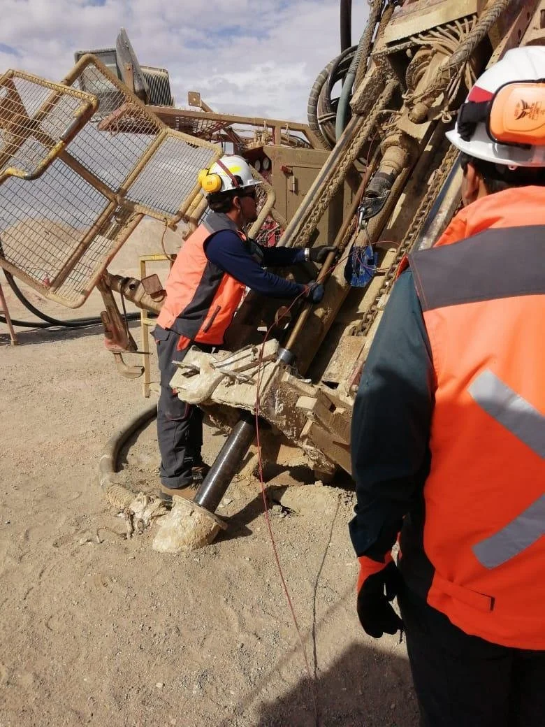
Purpose-built for diamond drilling and coring. Rapid deployment and high-end calibration for demanding environments.
✓ 35mm diameter ✓ 7.65kg weight ✓ 200h battery ✓ 1605mm length


Downhole navigationBlasting / ProductionGoGyro™ technical specifications
-
Standard config
Diameter: 35 mm
Length: 1605 mm
Weight: 7.65 kg
-
In-rod spacers config
Diameter: 35 mm
Length: 1857 mm
Weight: 9.45 kg
-
Stinger orientation config
Diameter: 35 mm
Length 2090 mm
Weight: 10.15 kg
-
Core retriever config
Diameter: 35 mm
Length: 1980 mm
Weight: 10.80 kg
-
Centralized config
Diameter: 35 mm
Length: 2570 mm
Weight: 12.60 kg
-
Accuracy
Inclination: ± 0.10°
Azimuth: ± 0.50°
Gravity high side: ± 0.15°
Gyro toolface: ± 0.50°
Position accuracy: < 0.2% (2m/1000m)*
Rate range: ± 100°/s
-
Performance
Temperature Range: -20°C to +80°C
Modes of operation: Memory, All inclinations, Continuous, MultiShot, Orientation
Battery time: 200 hours
Battery type: Rechargeable NiMH
Communication: Bluetooth
Power consumption: 0.2 W
-
Control
Software: Surveyor, Windows 10 & 11
Data management: SurveySafe cloud portal system
Recommended: Getac UX10, Fully rugged handheld, (MIL-STD-810G)
-
* Depending on borehole profile and survey procedure
In-house expertise
No robots, no automated hold music. With us, you will be connected right away to a real human, who knows just what your drill-site needs.
Our business manager can help find a local distributor, send a direct email today to: info@inertialsensing.com


FAQ’s
1
How can GoGyro™ increase time efficiency at drill-sites?
Through drastic reduction in rig downtime
On a drill site, time is money. Standard gyros require setting up a separate wireline winch, mechanical counters, and a tripod assembly over the hole-stopping the drill crew completely. GoGyro™ integrates directly into the daily drilling cycle. By attaching directly to the inner tube assembly (overshot mode), it records data while the tube is being lowered or pumped down to catch the next core sample. Operators turn mandatory "trip time" into "survey time" without halting the rig.
2
How do GoGyro™ handle harsh application environments?
We eliminate common hardware failure points
Cables, wireline wheels, and external depth encoders are notoriously fragile in harsh mining environments. They snap, get jammed with grit, stretch over long distances, or slip in wet and icy conditions, ruining the depth data. Because GoGyro™ is entirely autonomous and encoder-free, it strips away all those external moving parts. Operators switch to it because there is simply less hardware to break downhole.
3
What makes GoGyro™ reliable in borehole surveying?
GoGyro™ delivers reliable precision, even in harsh environment
Magnetic survey tools are useless near iron formations, steel casings, or underground infrastructure. GoGyro™ uses high-precision MEMS inertial sensors that are to prevent magnetic interference. Whether drilling through magnetic ore bodies or navigating tightly packed underground blasthole rings, it delivers continuous surveying (<0.2% position accuracy) regardless of surrounding environment.
4
How does GoGyro™ simplify drill-site operations?
We simplify your field operation
Field crews prefer GoGyro™ because it doesn't require tethering cables or pairing external Bluetooth depth wheels. Fewer steps mean less human error. You simply power it on, sync it wirelessly to a rugged tablet, and drop it down the hole. The Surveyor™ software automatically reconciles time-stamped motion data with known rod lengths, meaning even less-experienced crews can successfully pull a flawless survey log. Easley transfered with Inertial Sensing’s SurveySafe™ cloud-data management.
5
Why choose SurveySafe™ as cloud-data management?
Instant collaboration between site operator and project manager.
Historically, survey data lived on a USB stick or a local field computer until the end of the shift, or longer if the technician forgot to email it. Many engineers who upgraded their toolbox with an Inertial Sensing’s GoGyro™, also switched to the seamless SurveySafe™ cloud integration system. The moment the tool comes out of the hole and syncs to the tablet, the data is pushed to the cloud. Geologists and managers thousands of miles away can audit the process, and adjust the drill program in near real-time.